Gira tu dispositivo para una experiencia óptima
Gira tu dispositivo para una experiencia óptima


6 días

Playa

Naturaleza

Cádiz relax

Enter your email address and in a few seconds you will have the experience on your mobile so you can see it whenever you want.
We have emailed you the experience; enjoy Cadiz like never before.
Don't you get your experience?
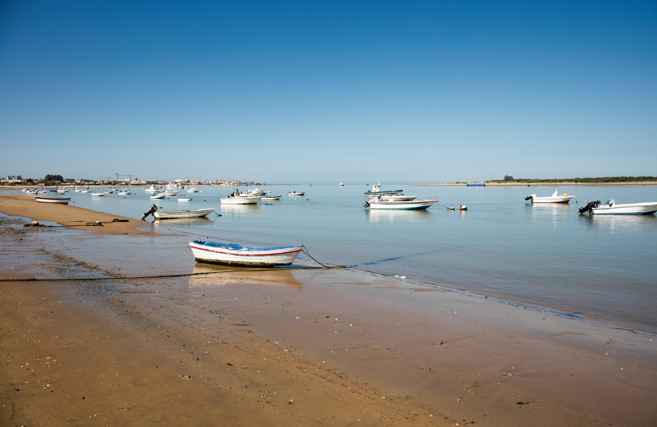
With 285 km of coast, the province of Cadiz can boast of having one of longest coastlines in the Iberian peninsula. You could practically walk along the seashore from one end of the province to the other, thanks to its 170 plus beaches. And it is the only province where you can enjoy the unique experience of bathing in the tranquil waters of the Mediterranean sea and in the immensities of the Atlantic ocean. But this journey is not for people who just want to lie down on a sun-lounge and get a tan. It's for people who enjoy seeing natural landscapes and finding unexpected corners, and for those who understand, or who are willing to understand, that a beach is not just a resource for tourism, it's an ecosystem that needs to be cared for and conserved to allow future generations to enjoy them too.
Pack a suitcase for six days. Don't forget your hat, sunglasses, footwear and comfortable clothes, sun cream, binocular, and, of course, a swimming costume and beach towel. Besides the proposals we've made in this experience, we'd recommend downloading the catalogue of beaches in the province of Cadiz onto your mobile: https://issuu.com/cadizturismo/docs/playas_provincia_de_c__diz/1?ff) and the catalogue of hiking trails (https://issuu.com/cadizturismo/docs/300senderoscadiz/53?e=3220287/1858612), and always keep them close by, just in case you fancy changing the route as you go.
You can do the journey whenever you want. We like the spring because of the colours the flowers bring to the countryside. Shall we get started?
Inserta aquí una nueva sección
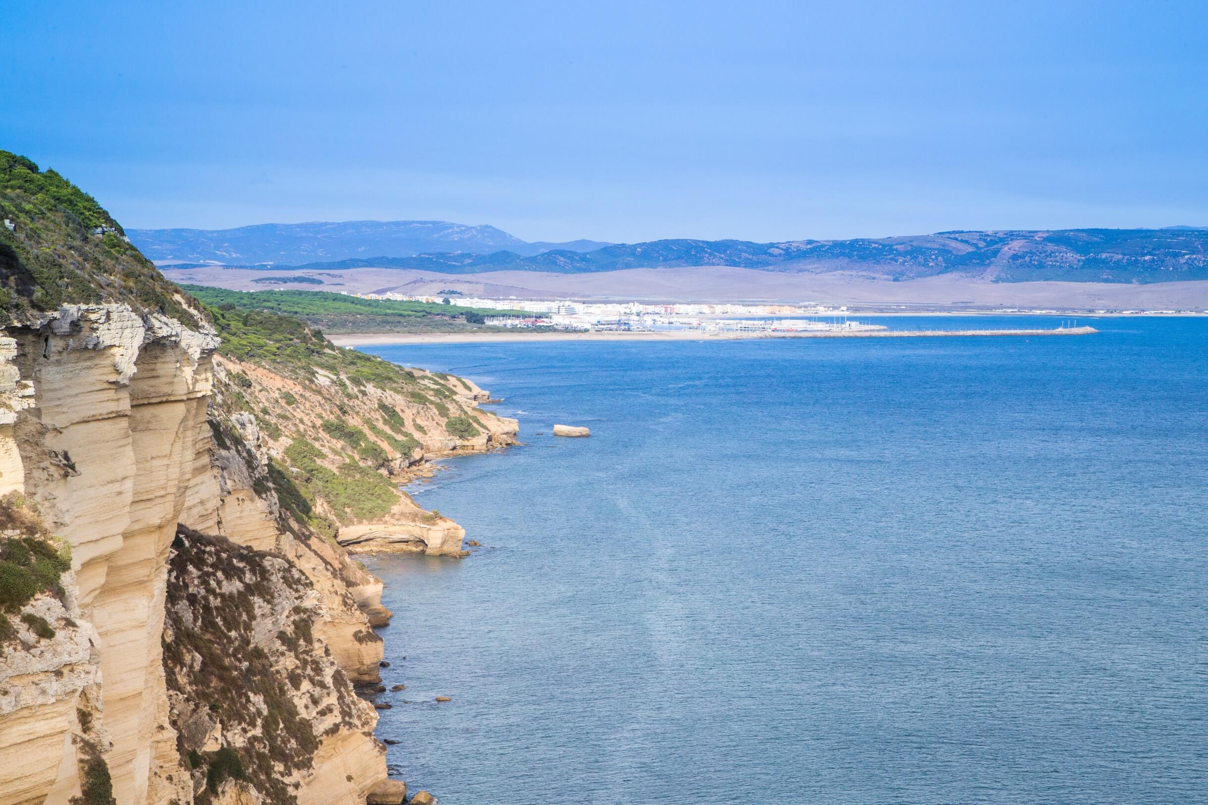
First day. We wake up in the charming town of San Roque, in the Campo de Gibraltar, after spending the night at one of its hotels https://www.sanroque.es/turismo/donde-alojarse9. The town has a thousand and one points of interest that are well worth a visit, but we're going to head off to our first stop: Cala de la Sardina beach. We reckon that the best way to take a trip along the coast of the province is to start at the beginning. And a great start is the beach that borders the province of Malaga. Besides the fun of being able to put one foot in Cadiz and the other in Malaga (to do that you have to go to the smaller of the two coves), you may be struck by its dark sands and the rugged cliffs that surround it. This beach is a complex of environmental interest, as it combines several different coastal habitats with their unique flora and fauna.
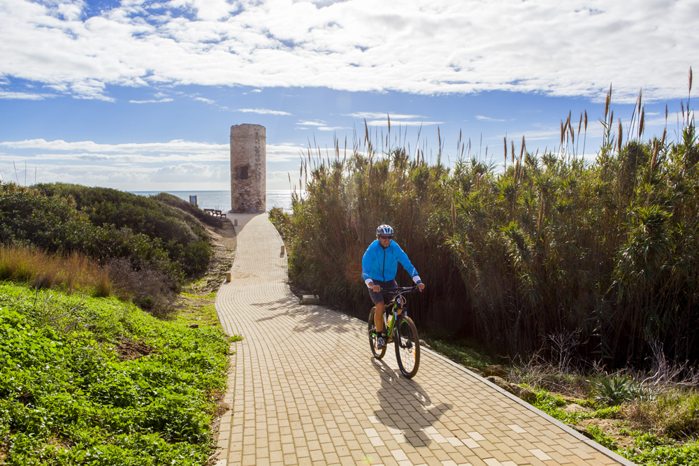
We could reach the next destination on foot, but that depends on the tides and our skills as a mountain goat. so it's better to take the car and enter “aparcamiento playa Torreguadiaro” in the GPS. You'll see a tumble-down tower. That's the Torre Quebrada or the Torre Vieja. It's an old defensive tower built in the 15th century. There are a lot of towers like this one, in various states of conservation, all along the coast of Cadiz. If you're keen on military history, there are some excellent guided visits to the structures built in the Second World War; ask at the tourist office in San Roque: 956 694 005-.
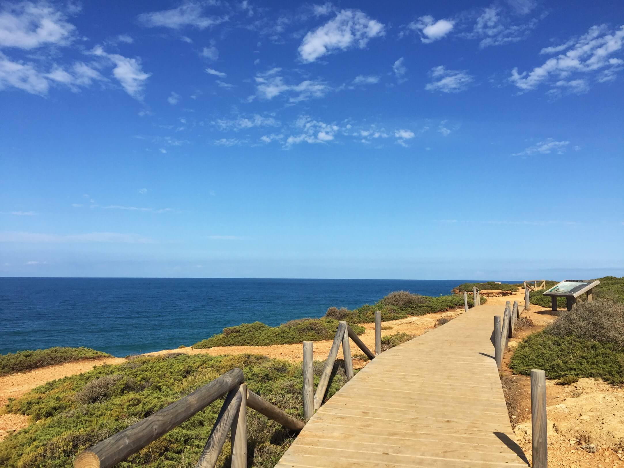
Where were we? Go down to the beach. We've come here to see the lagoon of Torreguadiaro, the remains of what was the old mouth of the river Guadiaro. You can see birds here all year long, the ones that have made this place their home, and migrating birds resting before taking the leap to the neighbouring continent. From the beach there are entrances to some walkways that surround it. There are information panels and viewing points where you can see the birdlife of the lagoon. This book tells you more about the birds to be seen in the province: Birding Cádiz https://issuu.com/cadizturismo/docs/birding_c__diz_espa__ol/1?ff
We'll complete the visit to the lagoon of Torreguadiaro by taking the trail of the natural route in Estuario del Guadiaro, just on the other side of the river. The entrance is in Calle Jaime el Conquistador. It's a very short semicircular route of less than 500 metres. You'll have the experience of seeing the only wetlands left in 100 km around the area. That, and its environmental importance make it a highly protected area.
Now we're off to Tarifa. We'll do the Colada de la Costa, a trail marked by the Parque Natural del Estrecho that runs along a cattle track (a public trail used shepherds for moving livestock) via the coastal cliffs between Tarifa and Algeciras. The complete route takes more than 10 hours there and back. We'll just do half. Even so, at a normal pace we'll be there for two hours.
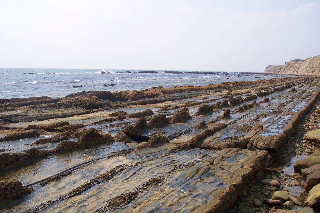
The trail starts at the end of Calle María de Molina. You'll see the panel indicating the trail near the southeast tower of the impressive walls of the Castle of Guzmán el Bueno, (10th century). Along the route, you'll enjoy some magnificent views of the Straits of Gibraltar, Africa and the curious geological formations of the cliffs and the wave-cut platforms in the inter-tidal areas. These are the outcome of tectonic movements made more than 20 million years ago. You'll also see bunkers, abandoned barracks and other defensive buildings typical of this part of the coast.
The end of our road is at the Torre Guadalmesí (16th century), another of the many watchtowers to be found here. This one, situated next to a river with the same name, was built there to prevent enemy ships from taking on water. It's a magnificent site for watching birds in full migration: white storks, European honey buzzard, black kite, griffon vulture, imperial eagle, Bonelli's eagle... In this idyllic landscape, we'll have some sandwiches with jamón serrano and local ecological cheese that we bought before in the local market.
If our calculations are correct, we should be back in Tarifa in the evening. That gives you time for a walk around the beautiful centre of the city and have dinner in one of the local restaurants https://turismodetarifa.com/.
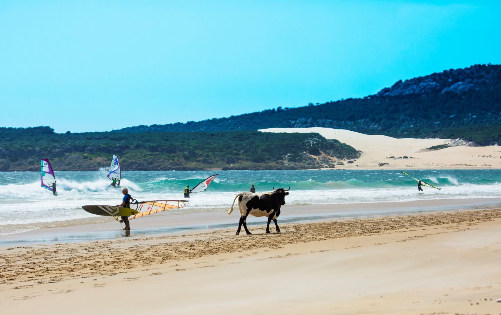
It would almost be a sin to travel along the beaches of Cadiz and not see the beaches of Bolonia or Valdevaqueros. We'll leave that up to you. Today we're off to the first one, because, amongst other things, we want to stop off at the cheese maker, El Cabrero de Bolonia. They make some delicious home-made ecological cheeses.
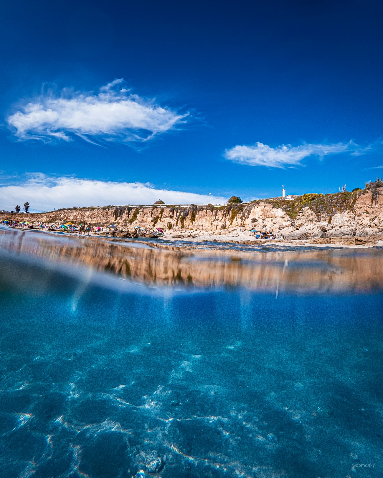
Bolonia beach is truly beautiful, so it's hardly surprising that the Romans fell in love with it and built their factory city, Baelo Claudia, right here. The natural queen of the beach just has to be the dune. It advances advance implacably, driven by the coastal winds towards a pine forest with stone pines, Portuguese crowberries and junipers, which are gradually being buried under the sand. Going up to the tope of the dune is an experience you cannot miss in this journey. If you've got some time to spare and the tide is low, you can go to the natural swimming pools, right on the other side of the beach. Or do the trail of the Faro Camarinal and admire the views of the Cabo de Gracia. So many lovely places to see!
So, back to our plan. We're going to Barbate. It'd be a good idea to get some supplies in for lunch just in case. For example some bread and pork shoulder in lard. The local food market is a safe bet and you'll love the paintings on the ceiling.
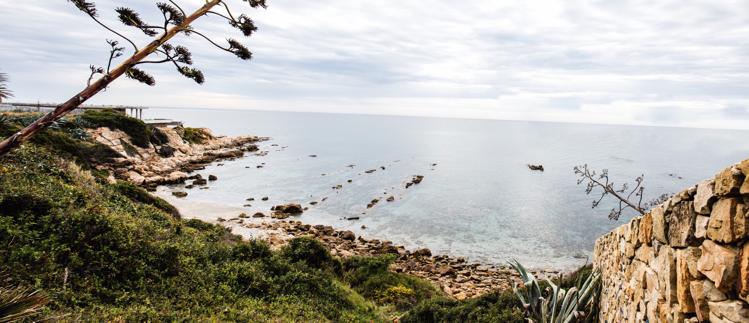
We're going to take the cliff top route of Los Acantilados de Barbate, right in the heart of the natural park of La Breña and the wetlands of the Barbate. This natural environment has a range of ecosystems: marine, cliffs, pine forest, wetlands and dunes. We'll leave the car at the entrance to the beach of Hierbabuena, walk along the shore towards the cliffs of El Tajo and access the trail by a path that you'll find right at the end.
Right at the top, at the highest point of the trail, is the Torre del Tajo (16th century). Entrance to the public is permitted at certain times. Ask at the information point of the natural park of La Breña and the wetlands of the Barbate (956 345 97 80) if there are any activities going on that day that mean that the tower is open to visitors. If not, you can still enjoy the views. The climb was well worth it, wouldn't you say? You're on one of the most important cliff tops of the Costa de la Luz, at 100 metres in height. Hundreds of thousands of years have made this landscape in which the old continent shows its wrinkles in the form of geological layers.
Near the tower there's a resting point between pine trees where we'll stop for lunch. Take out the bread, stick some port shoulder inside and voila! You've just turned a bread roll into a delicacy!
You could continue along the trail. It goes to the beach of Los Caños. But we prefer to retrace our steps, take the car there and have a cold drink in a beachside bar, we're not just here for the walking, are we?! In this website you'll find accommodation available in the area: https://www.turismobarbate.es/donde-dormir
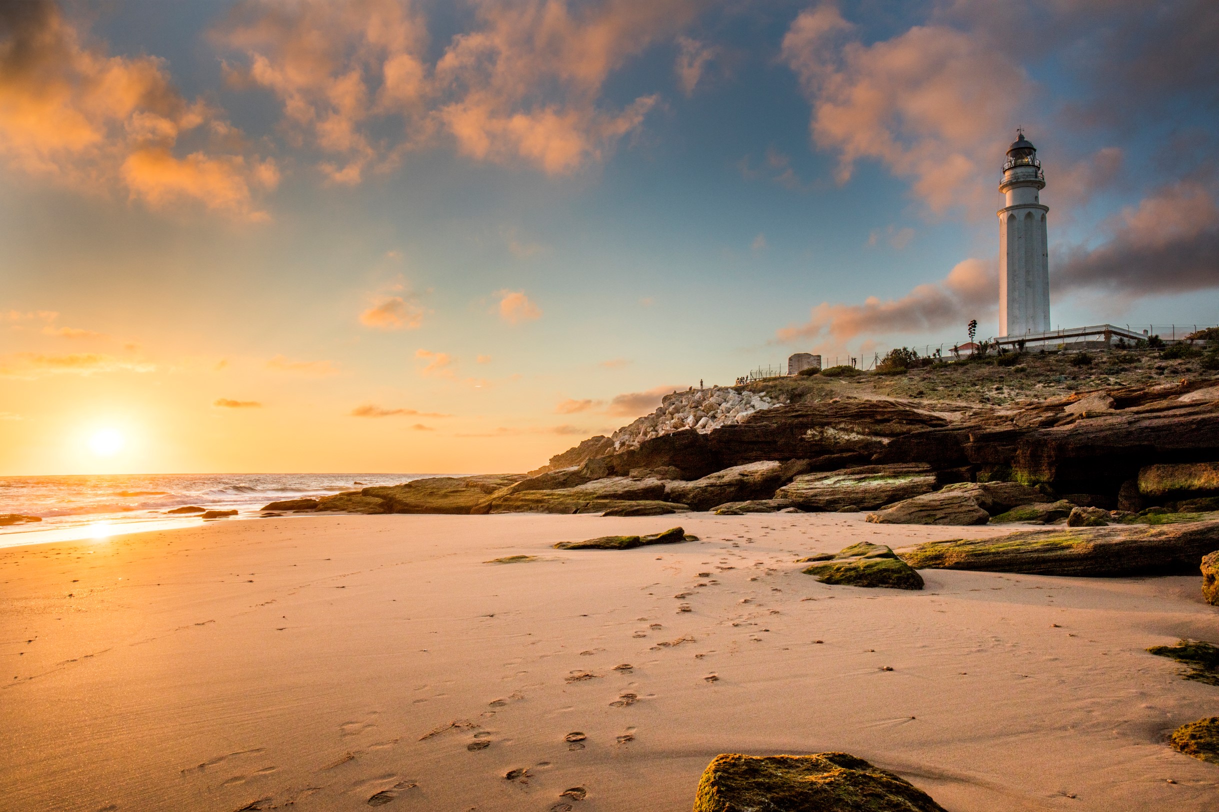
Third day of our journey. We're heading off to Conil de la Frontera. In the morning we're going to do a trail of low difficulty, a beautiful walk and a nice refreshing dip (don't forget your swimming gear!). We'll start the route near the lighthouse of Roche. It's an old 16th century watchtower, although the work done to adapt it to its job as a lighthouse has taken away some of its charm.
Here you can enjoy the views: the lighthouse of Trafalgar in the distance, the bay of Aceite, the beaches of Fuente del Gallo and La Fontanilla, Conil, the cliffs of Chiclana... Along the way, expert eyes will know how to read the geological history of the area in the rocks, a result of erosion by the sea, wind, elevation of the continent and the opening of the Straits of Gibraltar. There are several coves where we can go down and have a swim.
In the guides (https://www.cadizturismo.com/storage/app/media/RUTAS/Sendero%20Calas%20de%20Conil/Sendero%20Calas%20de%20Conil.pdf) the trail stops at the coastal pine forest of Roche, bordering Chiclana de la Frontera. It's of great ecological value, because of the endangered and highly vulnerable plant species to be found there. In fact, if the tide is low, you can do a few metres more to Encendida bay. We'll leave that up to you. If you're doing the trail in the opposite direction (from Chiclana to Conil) we recommend doing the Calas de Conil trail on horseback (reservations at Cortijo La Yeguada 608 660 579)
We know that your body is saying go, go, go. Because there's more sand and it's wonderful to just keep on going to what looks like to be the end, the cliffs of the beach at Barrosa. And it can be done. You decide, depending on the time you have. We'll head back on the trail, have a drink at a beachside bar, get the car, and head off to Chiclana de la Frontera.
We've arrived at the historic Torre del Puerco (16th century). This is the starting point of the Playa de La Barrosa route, which goes to Sancti Petri, about ten kilometres ahead. I don't know about you, but we'll pay homage to good old Spanish customs, take a few short cuts and do the route our own way.
First, we head to the viewing point of the Torre del Puerco, it's a good location to see birds, such as spoonbills, and we'll enjoy the views of the beach of La Loma, we'll take some selfies, head off to the hotel we reserved in El Novo for lunch and have a nice long siesta.
Then we'll visit one of what are called the Seven Magical Points of Chiclana, a set of locations that form part of a tourist route. This one's in the park of La Loma del Puerco, where the battle of La took place against Napoleon's troops. This natural setting is home to three species of narcissus of great ecological value.
Then we're off to the peri-urban park of La Barrosa, on the cliffs of Chiclana. There are signs along Calle Hércules indicating access to the viewing points in the park, with amazing views of the local coastline, the isle of Sancti Petri and the castle. This would be one of the main attractions of the boat trip we're going to do now. We've reserved a place to see a truly special sunset next to the legendary isle, where historians have placed the ancient temples of Melkart and Hercules, with relaxing music and a glass of sparkling wine (Information and reservations in Albarco: 617 378894). On the way back we can have dinner at La Casa del Farero, the Club Náutico de Sancti Petri (open every day in summer; the rest of the year, only lunch from Tuesday to Sunday), or at one of the local restaurants.
Good morning! Did you sleep well? Have a big breakfast and prepare some sandwiches because today's experience will take us all day.
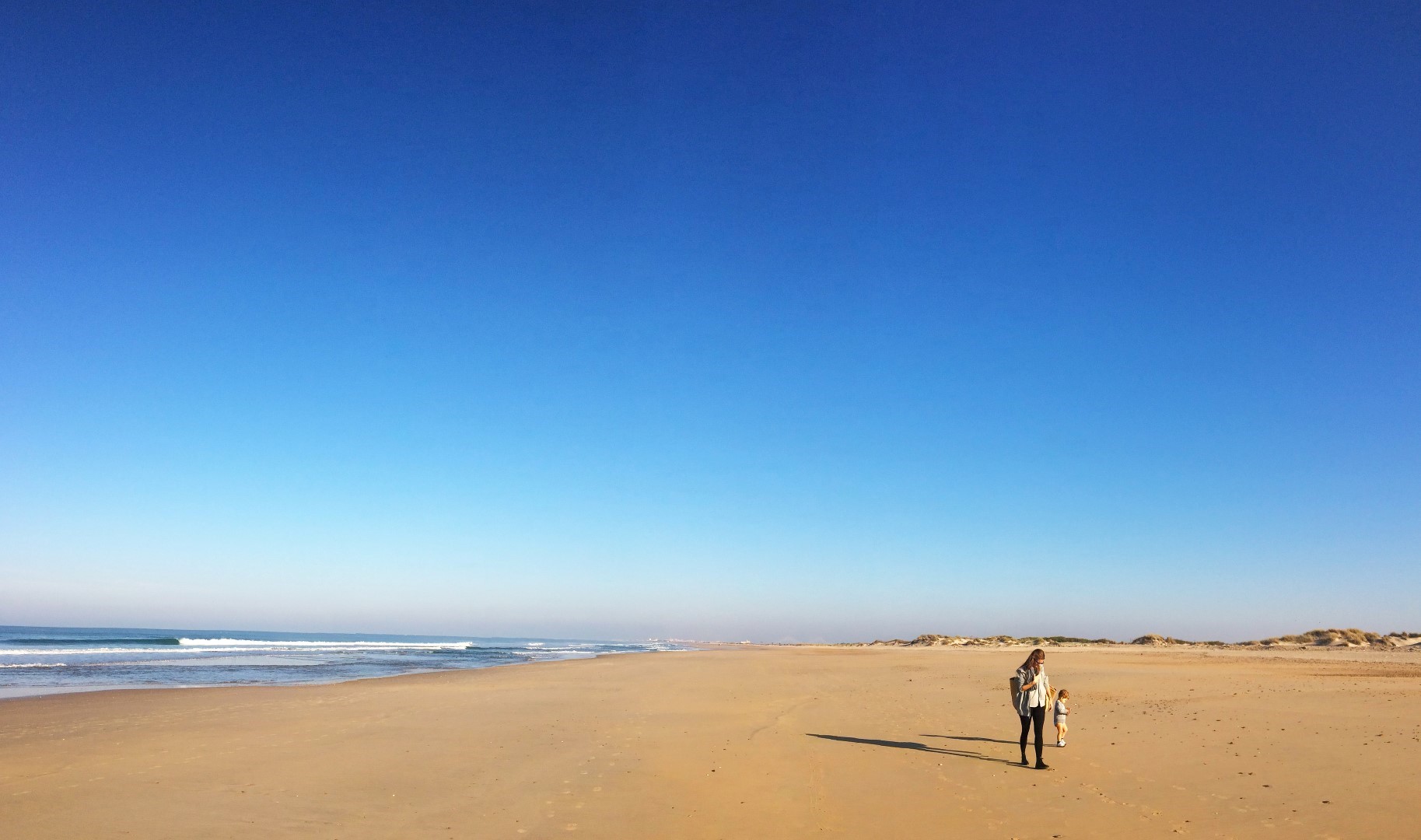
We're going to San Fernando, to the beach of Camposoto. We'll leave the car as close as possible to the last access point, where the untouched part of what is a natural beach commences. We'll hike to La Punta del Boquerón, a natural monument in the shape of an arrow of sand of great natural and geological value. The entrance is to the left as you go down.
We'll pass between dune systems and wetlands, with the species common to each one, on catwalks of wood and sand. We'll see the few remains of the defensive battery of San Genís and the better conserved battery of Urrutia (18th century), half concealed amongst the dunes and vegetation. Walking round here is great fun.
That's where the trail ends. Officially. You can go back if you want, but then you'd miss the best part. Keep on walking alongside the stream of Sancti Petri for about a kilometre. Keep on going, trust us. Can you see it? Now you've reached the point of the Punta, right at the mouth of the stream of Sancti Petri. Not a very accessible place, with very fine golden sand where you'll feel like the luckiest person in the world, as you look out and see all the coast of Cadiz you've been walking along open up before you.

You deserve a dip and some time to investigate. We'll do the return trip along the beach. The landscape is just as amazing. You'll see some imposing defensive structures that were recently abandoned. There is an area for dogs as well, where you can take the pooch for a walk.
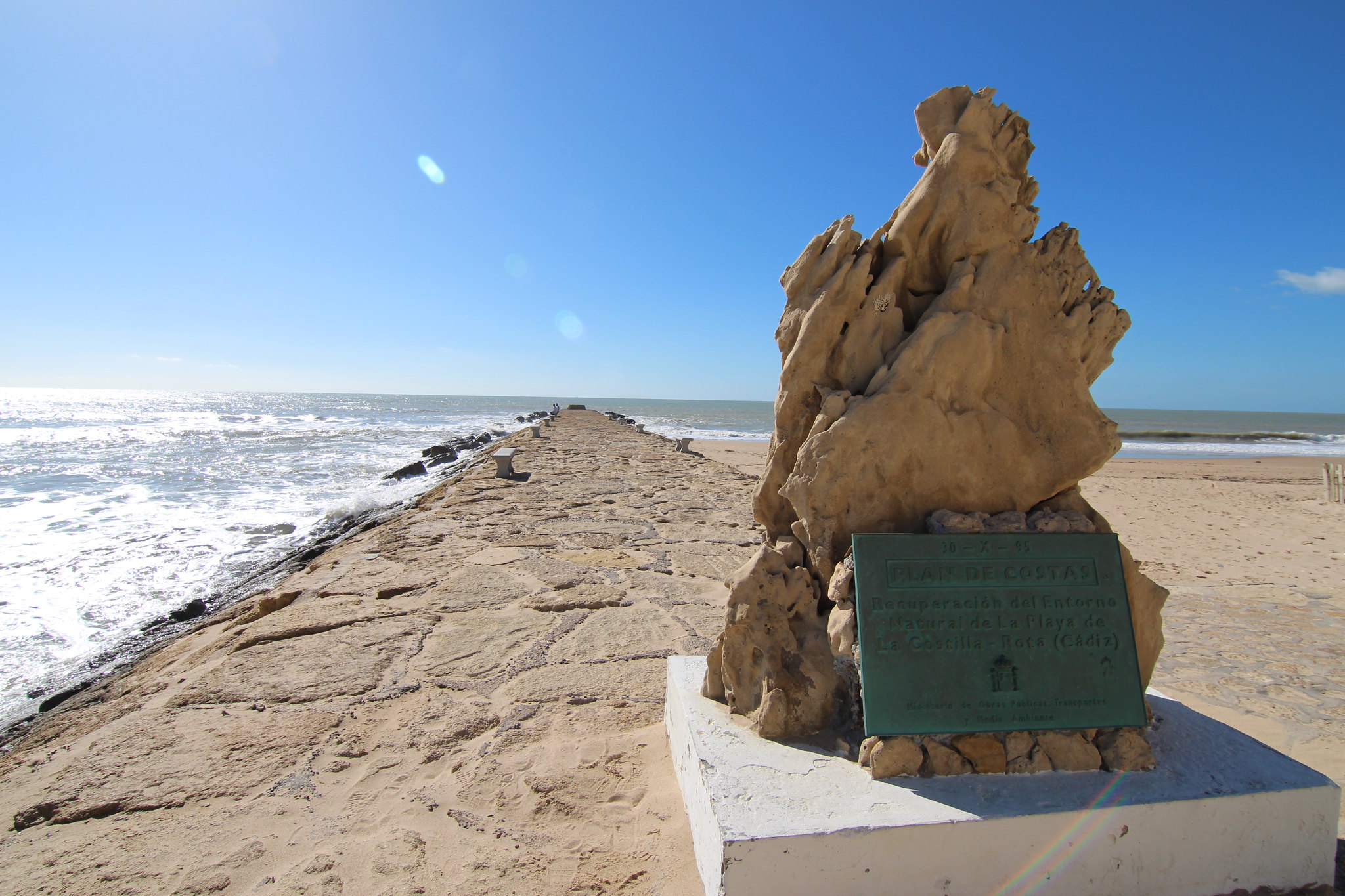
We know that today's walk isn't a difficult one but it is tiring because of the trek over dry sand and dunes. You can go back to La Isla, as we call San Fernando round here, have dinner in La Venta de Los Tarantos, or the Venta de Vargas, or at a restaurant in Calle Real. If you fancy some more, head off to the beach of Cortadura. It's the only one in the capital of the region that still has dune ridges. At low tide, you can see the rocky platform that runs all along this part of the coast.xº
Today we're off to El Puerto de Santa María and Rota. At El Puerto, we're going to go down to the beach of Levante. It's a natural beach that you can get to by walking from the beach of Valdelagrana or along the paths of the metropolitan park of Los Toruños. We also want to get to Los Saboneses point and see the entire area, and so we reserved some seats for a guided visit in an electric train (reservations in Puerto Campamento: 956910479). This beach is outstanding in environmental terms because it has one of the largest nesting sites for little terns in Europe, amongst other things.
Then we're off to Rota. We'll do the Pasarelas del Litoral trail. It's a very nice walk on catwalks, through a pine forest, from where we'll have access to the beaches and some viewing points. The route ends at the Celestino Mutis botanical gardens, where you can see and discover more about the local flora.
By now you'll have realised that the common chameleon is one of the emblems of the city. In fact is for the entire Atlantic coast of the province, because it's the last bastion of the species in the Iberian peninsula. We'll spend the night in Rota. Here are some options for a tapas session: https://www.aytorota.es/descubrerota/que-hacer/de-tapeo and hotels https://www.aytorota.es/descubrerota/donde-dormir.html Don't say we don't look after you!
We left the best part for the last day of the journey: A green route! We love green routes, because the reutilise disused infrastructures and give them new sustainable uses. This track runs along an old railway line that went from El Puerto de Santa María to Sanlúcar, passing though Rota and Chipiona. This is the section we'll do today.
There are several options. We'll start at Costa Ballena. We pick up the bikes we reserved (reservations at Bicicletas Valdés, tel. + 34 645479027) and start on a route that combines the Corredor Verde Litoral and the Vía Verde. The track is circular and goes over wooden catwalks, asphalt, gravel and earth for about 25 km. It's easy, there are hardly any gradients. On the outward trip, we'll go along the coastal part, over wooden catwalks and pass by the beaches of Camarón - La Laguna and Las Tres Piedras, of great environmental value (https://www.dipucadiz.es/desarrollo_sostenible/senderos/Corredor-Verde-Litoral-Costa-Ballena/).
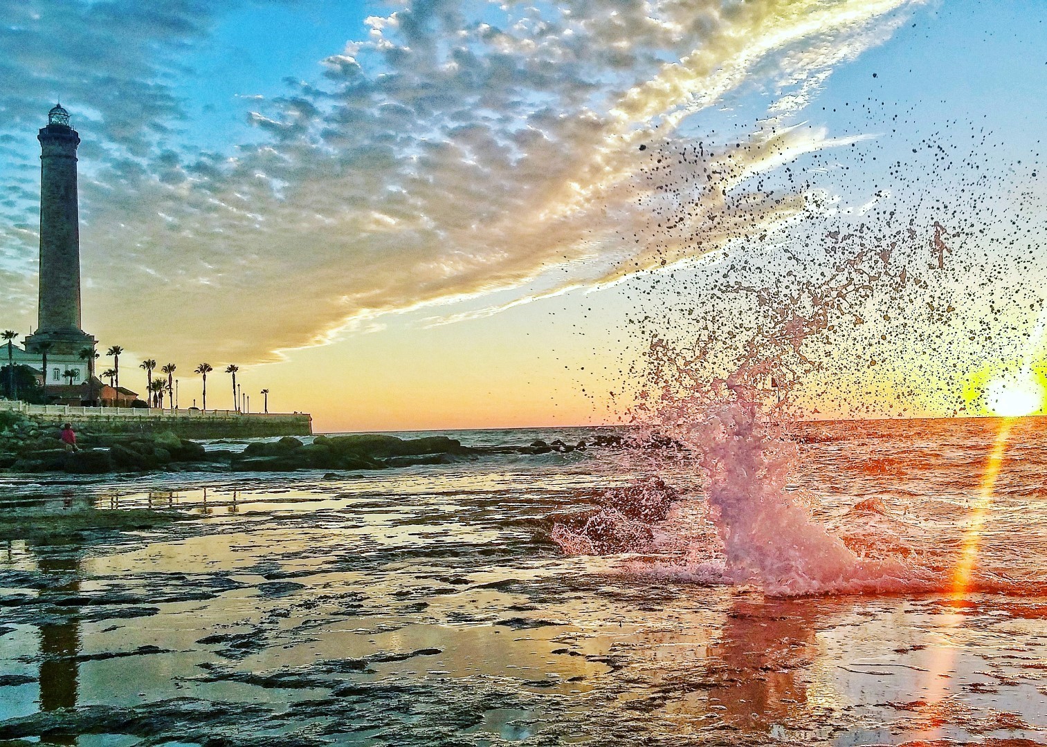
The idea is to make use of the day to walk around Chipiona. If you take the recommended route, we can stop at El Camaleón nature and coastal interpretation centre (Avda del Camarón), you can admire the impressive sanctuary of Nuestra Señora, see the highest lighthouse in Spain and the castle. Then we'll participate in a guided visit to the fish pens (the tourist office organises free visits in summer - + 34 956 929 065-).
We'll stop to have a drink nearby and head off back home. We'll take the bike path near the port of Chipiona and follow the signs to the green route. This part of the track takes you through farmland and pine groves on the way back to Costa Ballena.
The trip ends at Sanlúcar, at the semi-natural beach of Bajo de Guía, dipping our feet in the waters of the river Guadalquivir and planning the next trip. We've got so much to show you!
| Kilometres: 350 km. |
| Estimated driving time: 3 hours and 5 minutes |
| Recommended number of days: 6 |
| Attractions: Beaches and nature |
| See route in map: Google Maps |